


HAMMER SIGNYX The traffic committee, from request to decision
Live on ArcGIS · new app in development
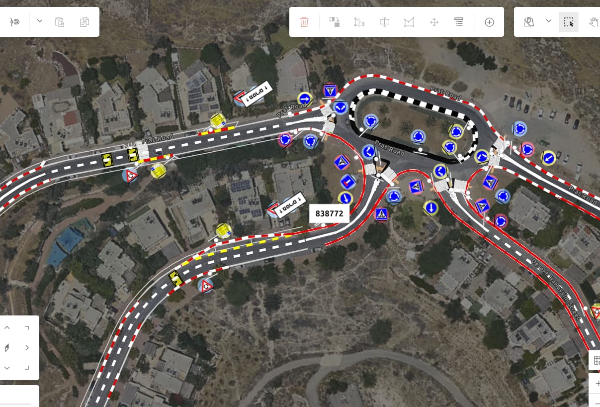
SIGNYX brings a traffic committee's work into one place: incoming requests, plans, map-based planning of signs, poles, road markings and disabled parking, meetings and decisions. The current ArcGIS-based edition is in daily use at an Israeli regional council. A new standalone web app is in development.
The problem
One decision, too many tools
A traffic committee's work is a long chain: a request from the municipal call centre, a plan to draw on the map, a meeting with an agenda, minutes, and expiry dates on disabled-parking permits to track. When every link lives in a different tool, it's hard to tell where a request stands, who owns it and what was finally decided.
Available today
SIGNYX on ArcGIS
The edition in use today is built on ArcGIS Online and covers the committee's working cycle:
-
Requests
Takes in requests from the Esh Bina municipal call-centre system.
-
Plans
Each request is managed as a plan with a status.
-
Planning on the map
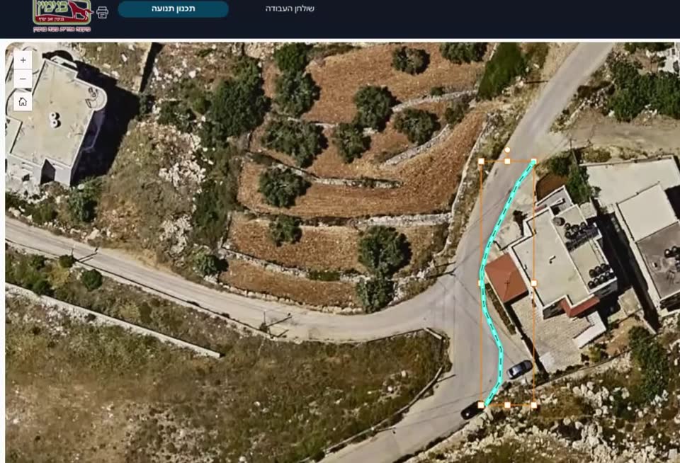
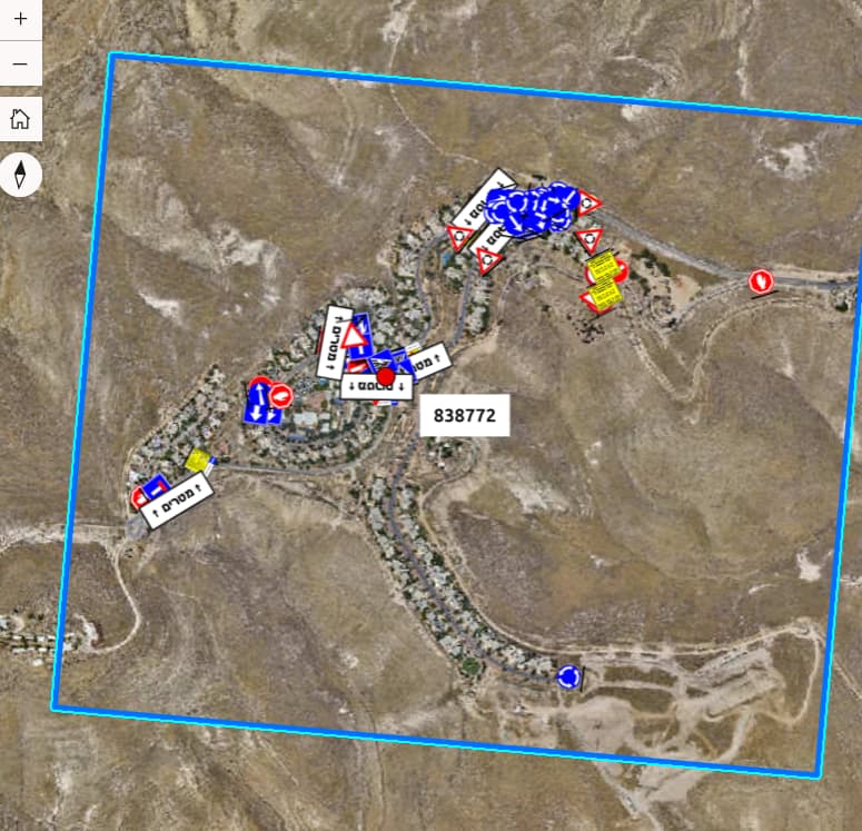
Signs, poles, road markings and disabled parking, drawn directly on the map.
-
Committees
An agenda and decisions for every meeting.
-
Agenda and minutes
Agenda and minutes produced as PDF files.
-
Disabled parking
Tracking of disabled-parking bays and permits.
How it works
The life of a request
-
Request
A request arrives from the Esh Bina system.
-
Plan
It becomes a plan with a status and an owner.
-
Planning
The planner draws signs, poles and markings on the map.
-
Committee
The plan goes on the meeting agenda.
-
Decision
The decision is recorded and the minutes are produced as a PDF.
-
Follow-up
Disabled-parking bays and permits stay tracked after the meeting.
In development
Next: a standalone SIGNYX web app
This is the planned scope of the new app, not what is available today. The goal: one system with proper role separation instead of several connected tools.
-
A "needs attention" home screen
Cards that show what is waiting for whom.
-
Requests inbox
Open a plan straight from any request.
-
Plan page with a timeline
Every status change in one place.
-
Focused planning map
The map opens on the selected plan, with A3 printing.
-
Meeting management
Drag-and-drop agenda, attendees and a meeting mode.
-
Closing a committee
A before-and-after preview, then a single write that either fully succeeds or changes nothing.
-
Disabled parking
A list of permits about to expire.
-
Roles and audit
Users, roles, an audit log and server-side PDF output.
Start in the field
HAMMER traffic-sign survey
Good sign management starts with an accurate inventory. In a HAMMER traffic-sign survey, a separate service, a vehicle with cameras and AI detection records the streets, then trained staff check the images and place every sign on the aerial photo. Each sign gets a type, direction, condition and photo, and the result is delivered as GIS layers of signs, poles and road markings.
-
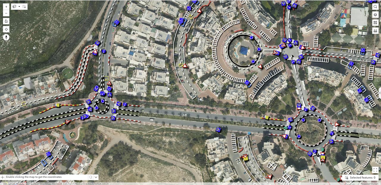
Traffic-sign survey web app: signs and markings over the orthophoto -
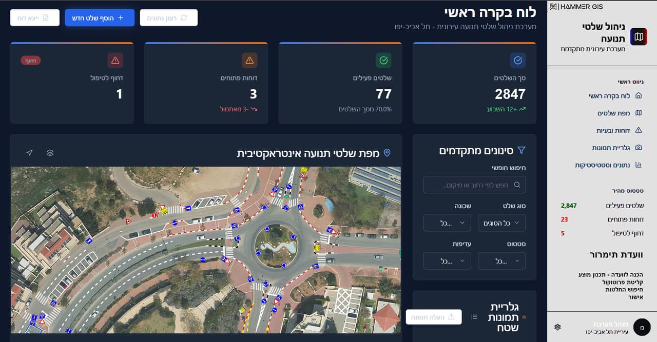
Dark traffic-sign control board with orthophoto map
Who it's for
Everyone around the committee table
-
Committee manager or coordinator
Agenda, decisions and minutes without chasing statuses.
-
Traffic planners
Signs, poles and markings planned on the map, tied to the plan.
-
Disabled-parking officer
Bays and permits tracked in one place.
-
Viewers and decision-makers
A clear picture of requests and decisions, read-only.
Use cases
Where SIGNYX does the work
-
Preparing a committee meeting
Ready plans go on the agenda, and the agenda comes out as a PDF.
-
Signs for a new street
From the request, through planning on the map, to the decision.
-
Recording decisions
Every decision is kept together with the plan it was about.
-
Following up on disabled parking
Bays and permits are managed over time, not just on decision day.
Integrations
What SIGNYX is built on
The current edition is built on Esri's ArcGIS platform. In the new app, ArcGIS Online remains the layer store.
- ArcGIS Online Sign, pole and marking layers
- ArcGIS Experience Builder Work interface in the current edition
- ArcGIS Dashboards Tracking dashboards in the current edition
- ArcGIS Survey123 Forms in the current edition
- Make Automations and PDF output in the current edition
- Esh Bina Incoming requests
Status
Two generations, honest status
SIGNYX on ArcGIS: live. This edition is in daily use by a regional council's traffic committee.
The new SIGNYX app: in development. It is not yet available to customers and has no announced launch date. Capabilities marked "Planned" on this page do not exist yet.
FAQ
What people ask us
What is SIGNYX?
SIGNYX is a system for running a municipal traffic committee: requests, plans, map-based planning of signs, poles, road markings and disabled parking, meetings, decisions and minutes. The live edition is built on ArcGIS Online.
Is SIGNYX available today?
Yes, as the ArcGIS-based edition in use at a regional council. A new standalone web app is in development and not yet available.
What is the current edition built on?
ArcGIS Online with Esri's Experience Builder, Dashboards and Survey123, plus Make automations that produce the agenda and minutes as PDFs.
Is SIGNYX connected to Esh Bina?
SIGNYX takes in requests from Esh Bina. Writing updates back to Esh Bina from SIGNYX is not part of the system today.
Does SIGNYX survey our signs?
No. The traffic-sign survey is a separate HAMMER field service that produces GIS layers of signs, poles and markings. SIGNYX runs the traffic committee's process.
What will change in the new app?
The goal is one system instead of several connected tools: role separation, a timeline for every plan, a meeting mode, committee closing with a preview, an audit log and server-side PDFs. All of this is planned and not yet available.
Do we need ArcGIS Online for SIGNYX?
Yes. The current edition is built on it, and in the new app the layers are planned to stay in the authority's ArcGIS Online.
Want to see it working for a real committee?
In a demo we'll follow a request from intake to minutes, and talk about the data you already have.