

GIS consulting and support GIS that works for your organisation, not the other way round.
Some municipalities start from nothing; others have a system nobody uses. We support both: we define what each department needs, set up and maintain the system, train the staff and build what is missing. The goal is an organisation that works with its spatial data on its own.
What it is
Technology, then process, then people
GIS service and support is the work that turns software and data into an organisational capability: scoping needs, setting up the system, training staff, ongoing support and custom development.
A GIS rarely fails because of the map. It fails when it does not fit how the department works, when nobody keeps it updated, or when staff do not know what it can do. So we start with the process and the people, and choose the tool afterwards.
What we do
Five service areas
-
GIS consulting and scoping
A review of what exists: layers, maps, apps and permissions. Needs mapped by department, a phased work plan and priorities. Support for planning teams, including layers for statutory plans under the MAVAT procedure.
-
Setup, implementation and maintenance
Your ArcGIS Online organisation: groups, permissions, maps, layers and pop-ups. Experience Builder apps, dashboards, Survey123 forms and Field Maps. Ongoing maintenance, layer updates and data-quality checks.
-
Department and staff support
Engineering, planning, operations and sanitation, revenue, security and emergency, electrical and lighting, the call centre and management. Each department gets the maps, forms and dashboards that fit its work, and we run the GIS day to day when there is no GIS specialist in-house.
-
Training
Role-based training, from map viewers to layer editors, on the organisation's own data. Short guides in Hebrew and tutorial videos for common tasks.
-
Custom development
Experience Builder widgets, automations between systems, an Excel sheet that updates a live map, scanned maps turned into layers, and purpose-built apps for a specific need.
How we work
A route with five stations
Not every organisation passes every station, or in this order. But every engagement is built on this route.
-
Consult and scope
Conversations with departments, a review of existing data and systems, and a definition of what must work on day one and what comes later.
-
Implement
Building maps, layers, forms and apps, loading data and setting permissions. When new data is needed, a survey is added.
-
Train
Each team is trained on its own system, with short guides that stay with the staff.
-
Support
Answers to questions and issues, layer updates, and periodic checks of data quality and permissions.
-
Develop
When a new need comes up, we build it: a widget, an automation, a form or an app, and feed it back into the route.
Tools
What we work with
Most of our work runs on Esri's ArcGIS platform, inside the client's own organisation. The data stays with you, in formats you can export at any time.
-
ArcGIS Online
Organisation management, hosted layers, maps and sharing.
-
Experience Builder
Map apps for staff and the public, including widgets we developed ourselves.
-
ArcGIS Dashboards
Dashboards for the call centre, management and survey tracking.
-
Survey123 and Field Maps
Forms and field data capture from a phone or tablet.
-
ArcGIS Pro
Data processing, editing, quality control and map production.
-
HAMMER CITY and CADabra
Our own products, which connect to your ArcGIS Online.
Examples
What it looks like in practice
-
Emergency GIS
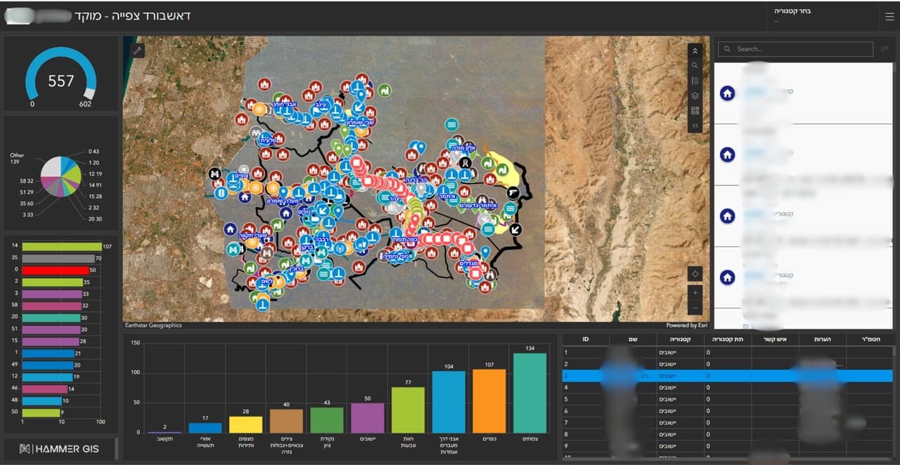
2D and 3D maps that also work offline, finding addresses, residents and infrastructure, sensitive sites, and producing lists and status reports in the field.
-
Asset management
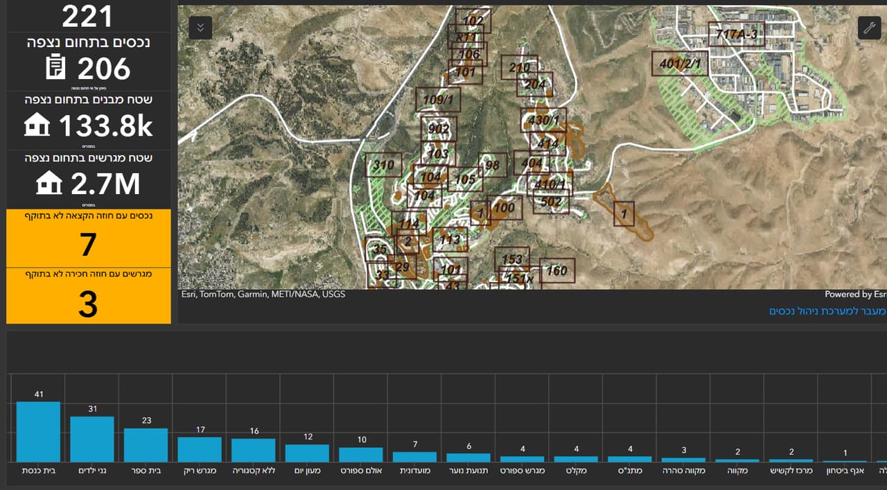
An app for updating assets, plots, leases and allocations, with map and table editing and a dashboard.
-
Call-centre dashboard
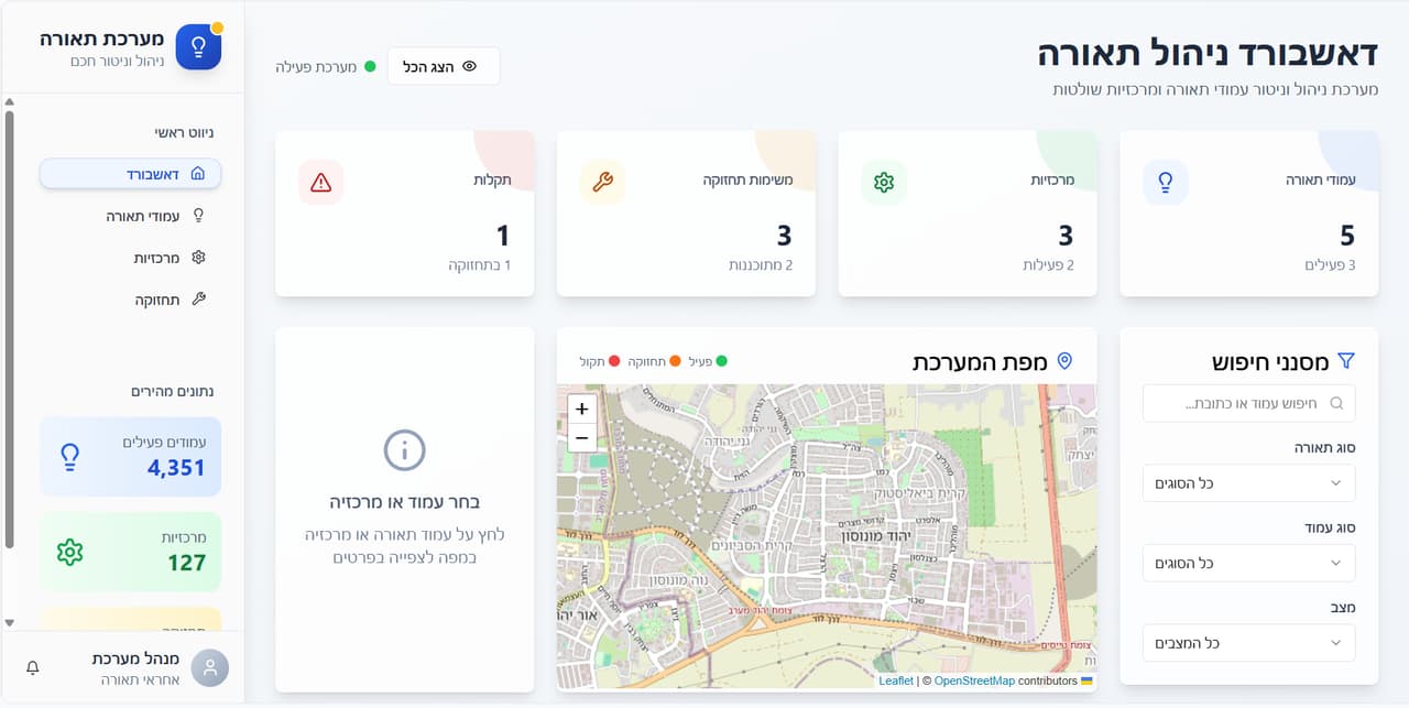
A map-based picture of service requests by type, area and status.
-
From Excel to a live map
At a municipality in central Israel, staff update a shared spreadsheet that becomes a live GIS map, without a full-time GIS operator.
-
Deceased locator
A cemetery app with a 3D view, for office staff and visitors.
-
Maps for residents
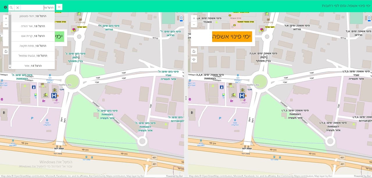
Waste and green-waste collection days, comparison maps and thematic maps, via a public link.
Engagement models
How to work with us
-
Pilot
One department, one neighbourhood or one app, to test the value before a wider commitment.
-
Defined project
Scope, deliverables and timeline set in advance: a system setup, an app or a data migration.
-
Ongoing support
A bank of expert hours for questions, updates and small developments, at your organisation's pace.
-
Managed GIS
We run your GIS: layers, permissions, updates and user support.
FAQ
Questions about service and support
We have ArcGIS Online and nobody uses it. Where do we start?
With a short review of what you have: layers, maps, apps and permissions, and conversations with departments about what they need. From there we build a phased plan that starts with one thing staff will actually use in the first weeks.
Do you only work with ArcGIS?
Most of our work runs on ArcGIS Online and Experience Builder, inside the client's organisation. We also work with open formats such as Shapefile, GeoPackage and GeoJSON, and convert data between systems, including AutoCAD.
Can staff update data themselves, without a GIS operator?
Yes, and that is one of the main goals. We build forms and processes that fit department staff, such as a field form or a shared table that updates a map, and train each team on its own data.
What does training include?
Role-based training on your own data: viewing and search, updating through forms, layer editing or ArcGIS Online administration. Each session leaves staff with a short guide in Hebrew and tutorial videos.
Can we start with a pilot?
Yes. Start with one department, one app or one neighbourhood, check that the system meets the need, and only then expand.
How does ongoing support work?
We agree in advance on a volume of hours and a contact channel. Within it we answer questions, update layers, fix issues and build small changes, and report on what was done.
Who owns the data and the system?
You do. We work inside the client's own ArcGIS Online, layers and maps are stored there, and they can be exported at any time in open formats.
What do you want to move forward in your organisation?
Tell us where you stand today, and we will propose the first station on the route.